
 Distance:
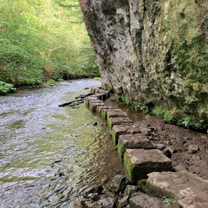
 2.2 miles (3.5 km)
Ascent: 122 metres
Grade: 29 (
Moderate)
Allow: 1h 15m to 1h 45m
Start: Millers Dale Car Park
Region: East Midlands

This route includes part of the Monsal Trail, former railway line, and starts and finishes at the Millers Dale car park which has a lovely cafe and public toilets in the old station – with the platforms intact. Leave the…

 Distance:
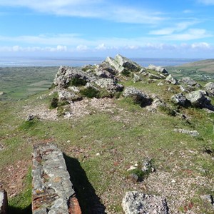
 3.9 miles (6.3 km)
Ascent: 219 metres
Grade: 31 (
Moderate)
Allow: 2h to 3h
Start: Worms Head Car Park, Rhossili
Region: Wales

Set in the Gower AONB this is a lovely walk with stunning views from the Wales Coast Path and Rhossili Down.
See MoreRhossili Down

Set in the Kent Downs AONB this is a lovely walk around the grounds of the home of Winston Churchill
See MoreChartwell, National Trust


 Distance:
 5.3 miles (8.5 km)
Ascent: 12 metres
Grade: 24 (
Moderate)
Allow: 2h to 3h 45m
Start: Aldeburgh Fort Green Car Park
Region: East of England

Set in the Suffolk Coast and Heaths AONB this is a delightful walk from Aldeburgh following the River Alde, then along the High Street and seafront.
See MoreAldeburgh

 Distance:
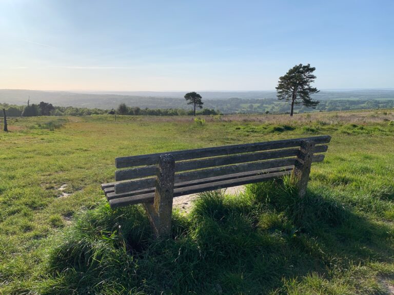
 7.4 miles (11.9 km)
Ascent: 289 metres
Grade: 38 (
Moderate)
Allow: 3h 30m to 6h 45m
Start: Pooh Bridge Car Park
Region: South East of England

Set in the High Weald AONB this walk begins by heading to Pooh Bridge, made famous by A.A. Milne.
See MorePooh Bridge, Newbridge, Gils Lap and Five Hundred Acre Wood


 Distance:
 6.7 miles (10.8 km)
Ascent: 21 metres
Grade: 26 (
Moderate)
Allow: 2h 30m to 4h 15m
Start: YHA Cambridge
Region: East of England

An interesting route along the river, through meadows and back along the guided busway.
See MoreGrantchester

A great walk to picturesque Dunster and along the seafront to Minehead.
See MoreDunster and Minehead

 Distance:
 6.9 miles (11.1 km)
Ascent: 47 metres
Grade: 32 (
Moderate)
Allow: 2h 45m to 4h 45m
Start: YHA Chester Trafford Hall
Region: North West of England

A walk through villages and nature parks.
See MoreStoak and Thornton-le-Moors


 Distance:
 9 miles (14.5 km)
Ascent: 180 metres
Grade: 39 (
Moderate)
Allow: 3h 45m to 6h 30m
Start: YHA National Forest
Region: East Midlands

A lovely walk through woodlands and countryside with industrial remnants.
See MoreMoira Furnace and Measham


 Distance:
 6.5 miles (10.5 km)
Ascent: 112 metres
Grade: 35 (
Moderate)
Allow: 2h 45m to 4h 45m
Start: YHA National Forest
Region: East Midlands

A lovely walk through the National Forest with lakes, woods and industrial history
See MoreMoira and Boothorpe

 Distance:
 5.9 miles (9.5 km)
Ascent: 191 metres
Grade: 36 (
Moderate)
Allow: 2h 45m to 4h 30m
Start: YHA Coalport
Region: West Midlands

A lovely walk crossing the River Severn to Broseley and returning through a nature reserve.
See MoreBroseley

 Distance:
 10.3 miles (16.6 km)
Ascent: 640 metres
Grade: 49 (
Moderate)
Allow: 5h 15m to 8h 15m
Start: YHA Clun Mill
Region: West Midlands

A hilly route through rural Shropshire’s fields and woodland.
See MoreSunnyhill and Clunton


 Distance:
 9.5 miles (15.3 km)
Ascent: 17 metres
Grade: 37 (
Moderate)
Allow: 3h 45m to 6h 30m
Start: YHA Stratford-upon-Avon
Region: West Midlands

A walk into Stratford-upon-Avon to enjoy the River Avon, Shakespeare attractions and the historic town.
See MoreShakespere’s Town


 Distance:
 8.3 miles (13.4 km)
Ascent: 98 metres
Grade: 36 (
Moderate)
Allow: 3h 30m to 5h 45m
Start: YHA Stratford-upon-Avon
Region: West Midlands

A walk to the Welcombe Hills Obelisk, providing views across Warwickshire.
See MoreWelcombe Hills

A lovely walk through pretty Buckinghamshire villages.
See MoreChalfont St Giles

A great woodland route following a section of the Greensand Way to an awesome viewpoint.
See MoreGreensand Way and Leith Hill Tower

A stunning route around Cheddar Gorge and back through the village.
See MoreCheddar Gorge

A walk along picturesque coastline.
See MoreTrevose Head

A pleasant route across Alcombe Common and to the village.
See MoreAlcombe

A pleasant route through docks, river gorge, woodland, city streets and parks.
See MoreClifton Suspension Bridge

A great walk with river, retail, railway, racecourse, Rowntree and ramparts!
See MoreBishopthorpe

A lovely wander around the outskirts of Scalby village and to the coast.
See MoreScalby


 Distance:
 6.8 miles (10.9 km)
Ascent: 106 metres
Grade: 25 (
Moderate)
Allow: 2h 45m to 3h 30m
Start: YHA Berwick upon Tweed
Region: North East of England

An interesting and varied walk showing the coastline and trade history of the area
See MoreBerwick, Tweedmouth and Spittal

 Distance:
 2.9 miles (4.7 km)
Ascent: 51 metres
Grade: 21 (
Moderate)
Allow: 1h 15m to 2h
Start: YHA Hathersage
Region: East Midlands

A lovely walk along the River Derwent
See MoreDerwent Valley


 Distance:
 4.4 miles (7.1 km)
Ascent: 74 metres
Grade: 24 (
Moderate)
Allow: 1h 45m to 3h 15m
Start: YHA Castleton Losehill Hall
Region: East Midlands

A lovely walk across the fields to Hope and back along the river to explore picturesque Castleton.
See MoreHope and Castleton

 Distance:
 6.6 miles (10.6 km)
Ascent: 475 metres
Grade: 47 (
Moderate)
Allow: 3h 45m to 5h 45m
Start: YHA Castleton Losehill Hall
Region: East Midlands

A stunning route through picturesque Castleton and along the impressive ridge.
See MoreMam Tor, Hollins Cross and Lose Hill

 Distance:
 5.7 miles (9.2 km)
Ascent: 248 metres
Grade: 38 (
Moderate)
Allow: 2h 45m to 4h 15m
Start: YHA Edale
Region: East Midlands

An enjoyable low-level walk through the upper Edale Valley.
See MoreEdale and Barber Booth

A great route taking in many stunning features.
See MoreJanet’s Foss, Malham Tarn and Malham Cove

Two out and back routes to the stunning Gordale Scar and Malham Cove, walk them together or in two parts.
See MoreGordale Scar and Malham Cove

A stunning walk around the lake, a perfect low level route or a great alternative if the weather is poor.
See MoreEnnerdale Water


