Distance: 2.8 miles (4.5 km)
Ascent: 50 metres
Grade: 13 (
Easy)
Allow: 1h to 1h 45m
Start: Wilverley Plain or Wilverley Inclosure car parks
Region: South East of England
Set in the heart of the New Forest between Burley and Brockenhurst this walk provides a straightforward route, on good tracks, through an enclosed woodland. There are views across heathland from the car park, but the route soon heads deep…
See MoreWilverley Inclosure
Distance: 1 miles (1.6 km)
Ascent: 13 metres
Grade: 9 (
Easy)
Allow: 30m to 45m
Start: Midhurst North Street Car Park
Region: South East of England
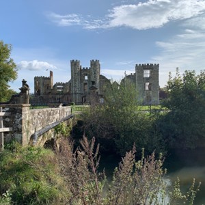
Midhurst is a charming West Sussex town in the Heart of the South Downs National Park. With castle ruins, historic buildings and waterways, a local museum, the South Downs visitor centre and lovely shops and places to eat and drink,…
See MoreMidhurst – South Pond
Distance: 2.2 miles (3.5 km)
Ascent: 122 metres
Grade: 29 (
Moderate)
Allow: 1h 15m to 1h 45m
Start: Millers Dale Car Park
Region: East Midlands
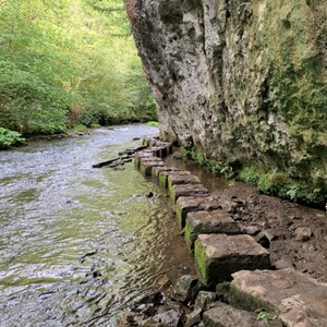
This route includes part of the Monsal Trail, former railway line, and starts and finishes at the Millers Dale car park which has a lovely cafe and public toilets in the old station – with the platforms intact. Leave the…
See MoreChee Dale Stepping Stones
Distance: 2.1 miles (3.4 km)
Ascent: 27 metres
Grade: 20 (
Easy)
Allow: 45m to 1h 15m
Start: Hartington Old Station Car Park
Region: East Midlands
A lovely route from Hartington’s old railway station. Payment required for the car park, there are toilets and a lovely takeaway in the old signal box selling drinks, ice-creams and a selection of food. The route begins on the Tissington…
See MoreTissington Trail, Hartington to Heathcote
Distance: 3.9 miles (6.3 km)
Ascent: 219 metres
Grade: 31 (
Moderate)
Allow: 2h to 3h
Start: Worms Head Car Park, Rhossili
Region: Wales
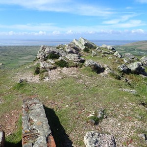
Set in the Gower AONB this is a lovely walk with stunning views from the Wales Coast Path and Rhossili Down.
See MoreRhossili Down
Set in the Kent Downs AONB this is a lovely walk around the grounds of the home of Winston Churchill
See MoreChartwell, National Trust
Distance: 5.3 miles (8.5 km)
Ascent: 12 metres
Grade: 24 (
Moderate)
Allow: 2h to 3h 45m
Start: Aldeburgh Fort Green Car Park
Region: East of England
Set in the Suffolk Coast and Heaths AONB this is a delightful walk from Aldeburgh following the River Alde, then along the High Street and seafront.
See MoreAldeburgh
Distance: 2.5 miles (4 km)
Ascent: 96 metres
Grade: 15 (
Easy)
Allow: 1h to 1h 45m
Start: Charmouth Road Car Park Lyme Regis
Region: South West of England
Set in the Dorset AONB this walk starts with stunning coastal views, drops into charming Lyme Regis and heads along the vibrant seafront to Cobb.
See MoreLyme Regis, Cobb, Langmoor Gardens and The Lynch
Distance: 7.4 miles (11.9 km)
Ascent: 289 metres
Grade: 38 (
Moderate)
Allow: 3h 30m to 6h 45m
Start: Pooh Bridge Car Park
Region: South East of England
Set in the High Weald AONB this walk begins by heading to Pooh Bridge, made famous by A.A. Milne.
See MorePooh Bridge, Newbridge, Gils Lap and Five Hundred Acre Wood
Distance: 2 miles (3.2 km)
Ascent: 29 metres
Grade: 11 (
Easy)
Allow: 45m to 1h 15m
Start: Bedelands Farm Nature Reserve carpark
Region: South East of England
A great walk through a local Nature Reserve on the outskirts of Burgess Hill.
See MoreBedelands Farm Nature Reserve, Burgess Hill
Distance: 6.7 miles (10.8 km)
Ascent: 21 metres
Grade: 26 (
Moderate)
Allow: 2h 30m to 4h 15m
Start: YHA Cambridge
Region: East of England
An interesting route along the river, through meadows and back along the guided busway.
See MoreGrantchester
A great walk to picturesque Dunster and along the seafront to Minehead.
See MoreDunster and Minehead
A rewarding walk through woodland, picturesque villages, open moorland with coastal views, and the town of Minehead.
See MoreHurlstone Point
Following country lanes and canal to Chester’s historic city walls.
See MoreShropshire Union Canal and Chester City Walls
Distance: 6.9 miles (11.1 km)
Ascent: 47 metres
Grade: 32 (
Moderate)
Allow: 2h 45m to 4h 45m
Start: YHA Chester Trafford Hall
Region: North West of England
A walk through villages and nature parks.
See MoreStoak and Thornton-le-Moors
Distance: 9 miles (14.5 km)
Ascent: 180 metres
Grade: 39 (
Moderate)
Allow: 3h 45m to 6h 30m
Start: YHA National Forest
Region: East Midlands
A lovely walk through woodlands and countryside with industrial remnants.
See MoreMoira Furnace and Measham
Distance: 6.5 miles (10.5 km)
Ascent: 112 metres
Grade: 35 (
Moderate)
Allow: 2h 45m to 4h 45m
Start: YHA National Forest
Region: East Midlands
A lovely walk through the National Forest with lakes, woods and industrial history
See MoreMoira and Boothorpe
Distance: 16 miles (25.7 km)
Ascent: 513 metres
Grade: 58 (
Challenging)
Allow: 7h 15m to 12h
Start: YHA Coalport
Region: West Midlands
Along the picturesque River Severn to Much Wenlock, returning through Shropshire countryside.
See MoreMuch Wenlock
Distance: 5.9 miles (9.5 km)
Ascent: 191 metres
Grade: 36 (
Moderate)
Allow: 2h 45m to 4h 30m
Start: YHA Coalport
Region: West Midlands
A lovely walk crossing the River Severn to Broseley and returning through a nature reserve.
See MoreBroseley
Distance: 4.4 miles (7.1 km)
Ascent: 76 metres
Grade: 19 (
Easy)
Allow: 1h 45m to 3h
Start: YHA Coalport
Region: West Midlands
This walk passes through lovely countryside and highlights the industrial history of the area.
See MoreCoalport and Ironbridge
Distance: 10.3 miles (16.6 km)
Ascent: 640 metres
Grade: 49 (
Moderate)
Allow: 5h 15m to 8h 15m
Start: YHA Clun Mill
Region: West Midlands
A hilly route through rural Shropshire’s fields and woodland.
See MoreSunnyhill and Clunton
Distance: 3.1 miles (5 km)
Ascent: 19 metres
Grade: 11 (
Easy)
Allow: 1h to 1h 45m
Start: YHA Cambridge
Region: East of England
A short walk for many, but with botanic gardens, a children’s play park and pool, punting and excellent pubs on offer, it could be a whole a day out.
See MoreGardens and Parks
Distance: 4.2 miles (6.8 km)
Ascent: 12 metres
Grade: 14 (
Easy)
Allow: 1h 30m to 1h 30m
Start: YHA Cambridge
Region: East of England
A great walk with historic buildings, academic institutions, museums, waterways and shopping.
See MoreCity and Colleges
Distance: 8.3 miles (13.4 km)
Ascent: 98 metres
Grade: 36 (
Moderate)
Allow: 3h 30m to 5h 45m
Start: YHA Stratford-upon-Avon
Region: West Midlands
A walk to the Welcombe Hills Obelisk, providing views across Warwickshire.
See MoreWelcombe Hills
Distance: 9.5 miles (15.3 km)
Ascent: 17 metres
Grade: 37 (
Moderate)
Allow: 3h 45m to 6h 30m
Start: YHA Stratford-upon-Avon
Region: West Midlands
A walk into Stratford-upon-Avon to enjoy the River Avon, Shakespeare attractions and the historic town.
See MoreShakespere’s Town
Distance: 3.7 miles (6 km)
Ascent: 76 metres
Grade: 20 (
Easy)
Allow: 1h 30m to 2h 30m
Start: YHA Jordans
Region: South East of England
A wander through the lanes and paths around Jordans.
See MoreAround Jordans
A lovely walk through pretty Buckinghamshire villages.
See MoreChalfont St Giles
A great woodland route following a section of the Greensand Way to an awesome viewpoint.
See MoreGreensand Way and Leith Hill Tower
Distance: 4.6 miles (7.4 km)
Ascent: 27 metres
Grade: 18 (
Easy)
Allow: 1h 45m to 3h
Start: YHA Cheddar
Region: South West of England
A lovely route along an old railway line to a picturesque town and back along quiet country lanes.
See MoreAxbridge
A great route taking in Cheddar Gorge, the Mendips and a lovely town and villages.
See MoreCheddar Gorge and Black Down