It was great to be involved with Youth Hostels Association’s (YHA) Festival of Walking. My role included identifying three routes for each participating hostel that started and finished at the front door, establishing the route card template and identifying what information would be included.
YHA has 90 year history of walking, providing bunk houses, and more recently, very well serviced affordable accommodation with both dorms and comfortable private rooms available. There are now no chores, and excellent bars, cafes and communal kitchens and lounges. They have a hard-core walker following and some of the country’s greatest hikers and climbers are friends of YHA. But my brief for the Festival of Walking was clear – provide walks for all.
And all means all. Something for the experienced walker to enjoy or challenge themselves with. Something for the recreational walker to get outdoors. But these two groups are already very well served by walking guides, and YHA particularly wanted to extend walking to beginners, families and to people who currently face barriers to accessing the outdoors – have a look at their work on Generation Green and Outdoor Citizens. Access is also under focus from Sport England with their Uniting the Movement strategy – “We’ll focus disproportionately on people who face the most barriers to activity, so they can have improved access to opportunities in inclusive, safe and accessible environments.” And many other organisations such as The Ramblers, The National Trust, Canal and River Trust and Forestry England have taken great steps towards increasing access by building accessible infrastructure and promoting routes. YHA are also working with the amazing Debbie North to increase wheelchair accessible routes.

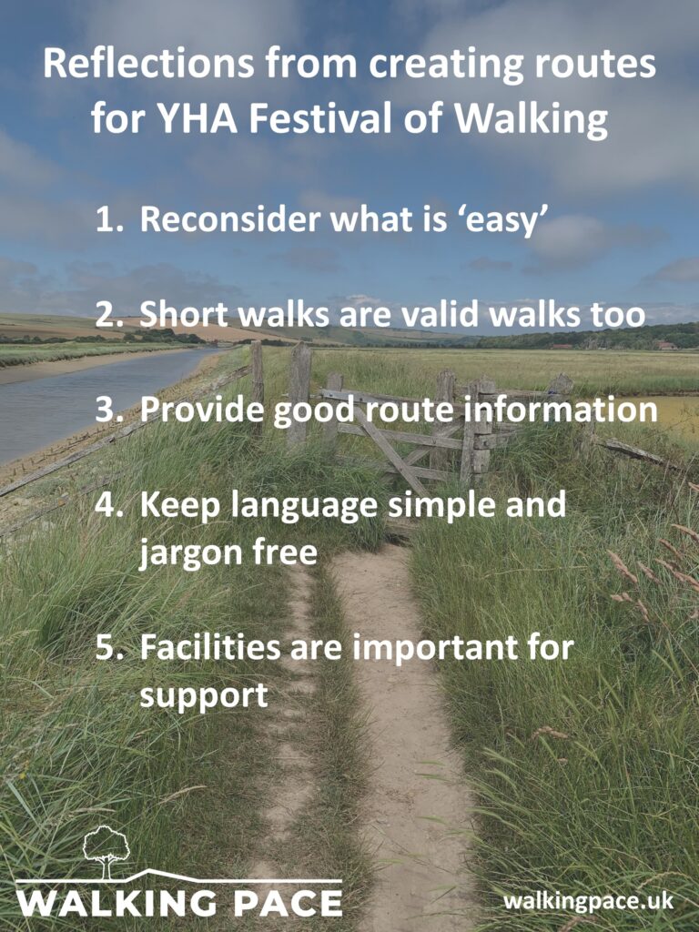
Below are some of my reflections from producing YHA Walks and my wider expertise in charity and access
1. Reconsider what is ‘easy.’
YHA wanted an ‘easy’, ‘moderate’ and ‘challenging’ route for each hostel. There we find the first challenge. How often have you taken the advice that a route was ‘easy,’ only to find your lungs exploding and legs like jelly half way round (or more likely halfway up). If you haven’t felt that, then maybe you are the one offering the ‘advice’. I know that once I get home, and look at the photos of the great views, I get selective amnesia which eradicates the pain. What is ‘easy’ for one person, may be a challenge for another – injury, fitness, disability all play a part, as well as technical ability and kit.
YHA deployed an amazing group of volunteers to check the walking routes, and within them was diverse range of walking ability. All were experienced walkers, but some fitter than others and some had additional training, such as Mountain Leader qualifications. It was clear that a subjective assessment of grade would be difficult to standardise and so a more objective approach was taken.
A new approach to route grading was developed to provide a single numerical value for each route. More information on how the grade was calculated is here and you can enter route details to calculate the grade of your own routes. The grade accounts for more than the technical level or effort. It is based on the factors which can make walking more difficult, including: distance, ascent, gradient, terrain, impact of weather, getting lost and not having the right kit. The grading system was also designed to compare all types of walk from a bimble through a town centre to a high level exposed ridge route, and for YHA Walks the grade varies from 7 to 81. The numerical grade was equated to broad categories of Easy (0 to 20), Moderate (above 20, under 50), Challenging (50 to 70), or Severe (over 70) to help provide a reference point for the grade.
As well as being well received by walkers, the grade was very helpful for me when identifying routes – especially at the ‘easy’ end. The location of some hostels, high above sea-level and on a steep hill, meant that the one mile walk to the pub graded over 20, beyond ‘easy.’ For lower hostels, on flatter ground and with well paved paths was possible to get a four mile walk and remain ‘easy’. The grade was also helpful at the severe end, recognising where routes might be a little too adventurous.
On investigation, the short routes to the pub would be hard for some, they were steep and heavy going. Not a consideration for many, it’s not a problem. But for those who have to pick the shortest line because each step is an effort or painful, it would a challenge. At the time my wife, an Executive Director at YHA, was struggling to walk with dodgy knees – so easy walks had in mind how she might cope. Only for a few hostels in mountainous locations was it not possible to find an easy walk worth walking, and we had to settle for a low graded moderate.
Guests have reflected that the grading number has helped them to select routes and to move up and down walk difficulty, or to select walks that are within their capabilities.

2. Short walks are valid walks too.
All too often short walks are a short-cut of a longer route. Route cards show an eight mile tour through wonderful scenery, but ‘if you cannot manage that’ then you can take the easy path which reduces the walk to three miles. Whilst it is important to know where the escape routes are, and for many the three rather than the eight mile loop is by choice, not necessity – that is fine. But if short walks are always the lesser part of long walks then it will always feel incomplete or like a failure. Even in guide books with ‘short walks’ most are about three miles. I have one book with many routes under two miles – but that one is called ‘Kiddiwalks.’ The YHA’s shortest route is 0.4 miles, a beautiful route in Snowdonia. It has received exactly the same attention and route card development as much longer routes. For some, this walk would be an achievement, for others this walk may be just what they are looking for at that time. They do not need to, or want to, know about the miles they cannot, or do not intend, to walk.
3. Provide good route information.
To help walkers make the right decision about which walk to do we aimed to provide lots of useful information. This is handy for the experienced walker, but essential for people new to walking – as they may require additional scaffolding to provide the confidence to get outside. Part of this was the route card itself, but other tools were produced to help new walkers. This great booklet, in collaboration with The BMC, provides guidance to new hill walkers and a page of advice on the YHA website.

The level of information provided on routes was determined by the route’s grade. Routes graded over 35 (upper moderate, challenging and severe) would most likely be undertaken by experienced walkers and therefore less information was provided. Those graded under 35 would be the routes most likely to be undertaken by beginners – and therefore additional information was provided. Urban routes were adjusted slightly as many features of the outdoors were not necessary and there were too many facilities to list!
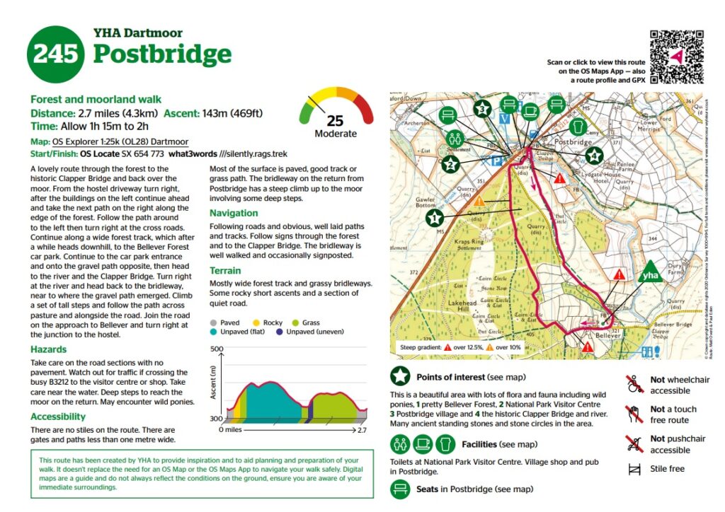
We produced route cards not a guide book and therefore information was restricted to a single side of A4, we avoided putting route information on the reverse as this may be lost if routes were photocopied. We added as much information as we could onto the page – much to the delight of the graphic designer, who did an outstanding job of presenting all the information in a useful format.

Identified by the excellent team of route checking volunteers the route cards included: a description of the route, hazards, terrain description and map, gradient profile and points of interest. We used icons to quickly show accessibility and facilities. Maps of routes graded over 35 have similar information, but in a less visual format – this accommodated the larger maps required for longer routes.
For some there is more information than they need. For others they may have wanted more. But overall the feedback has been very positive and the inclusion of facilities, stiles and terrain conditions has been welcomed. We included OS maps. Personally I prefer guides with ‘proper’ maps, rather than hand drawn or re-drawn reduced maps. For some this may be intimidating and take them back to their days in the Guides, Scouts or Duke of Edinburgh. However, along with the descriptions, the maps soon become easy to read and, with the QR code link to the OS Maps app, it becomes even easier to follow the route on a mobile phone. Additionally, becoming familiar with OS Maps through the easier routes with build skills for tackling the more difficult ones.
4. Keep language simple and jargon free.
We tried to keep the language clear and simple. The route cards are small, and so there is no room for lengthy descriptions or superfluous commentary. The temptation to include flowery descriptions, interesting footnotes about the history of the area or humour was overwhelming, but there was no room and these comments would have served little purpose to assist walkers to follow the route. We wrote the instructions in the order they occur, for example, rather than ‘before arriving at the lake take the path on the left and pass through the woods.’ we would write ‘take the path on the left, pass through the woods and continue to the lake.’ This makes the instructions easier to understand. We avoided using too much walking technical jargon. East and west were, where possible, replaced with left and right. Ascend and descend generally gave way to up, down and follow the path. Words like col, grough and crag were avoided or used sparingly.
5. Facilities are important for support.
Facilities are a key factor for many when choosing a walk. There was a time when I would choose a walk in the most remote areas possible. Now I like a cup of tea and a loo at least at the start/finish. For many though the availability of toilets and somewhere to get a drink is an essential component of their day out. A pub or a cafe provide an essential rest stop or shelter from bad weather. Regular seats can can help people with mobility restrictions or difficult breathing to recuperate for the next phase. Families with young children might want to know there is a toilet or place to get a bite to eat. YHA Walks also mention key points of interest such as museums, parks and interesting buildings which can help to break up a walk too.
For YHA Walks we did not consider public transport, as the walks start and finish at hostels – and public transport is covered elsewhere. Although this is an important factor for many to be able to access a route. And the transport must be close to the start of the route. A bus stop a mile away from the start/finish of a two mile walk is not helpful if two miles is the limit.
Starting a walk from a YHA though does provide excellent support. There are toilets at the hostels. Walks can be begin after a lovely cooked breakfast and be followed by relaxing in the bar or with an evening meal. All have facilities to refill water bottles and many have drying rooms to get kit ready to go again the following day.
Go walking
I had a great time working with YHA on their walks and the team of volunteers and staff were amazing. YHA and walking go hand in hand and their venues – rural or urban – are fantastic bases to explore on foot from. The route cards we have created have pushed new ground on route grading and provide key information to help walkers choose the route that is right for them. There are walks for all. There are short, long, easy, hard, scenically stunning, culturally interesting, isolated, honey-pot site visiting, steep, flat and rugged walks to choose from. Find your route here, and go walking, enjoy!


Awesome piece of work and well documented. A credit to yourself and the YHA.
A very useful insight that others can follow. We will definitely look to apply some of this thinking to the walks we promote in the National Forest.